
Riverside ZIP Code Areas at a Glance
Riverside's postal map starts with the official 2020 Census ZCTA-to-place relationship file. It identifies twelve geographic tabulation areas whose polygons intersect the City of Riverside place boundary. A ZCTA is a statistical approximation of delivery geography, not a promise that every address in the polygon carries the same postal code. The table keeps the distinction visible. It also avoids naming stations that the research could not verify from an authoritative USPS list.
| ZIP Code | Areas Covered | Post Office | Notes |
|---|---|---|---|
| 92501 | Core and north-central Riverside | Confirm by USPS address lookup | Large central overlap with the city |
| 92503 | West and southwest Riverside | Confirm by USPS address lookup | Geographic ZCTA intersection |
| 92504 | Central and southwest Riverside | Confirm by USPS address lookup | Geographic ZCTA intersection |
| 92505 | La Sierra and western Riverside | Confirm by USPS address lookup | Geographic ZCTA intersection |
| 92506 | Central and southeast Riverside | Confirm by USPS address lookup | Geographic ZCTA intersection |
| 92507 | East and northeast Riverside, including the UCR vicinity | Confirm by USPS address lookup | Geographic ZCTA intersection |
| 92508 | Orangecrest and Mission Grove southeast | Confirm by USPS address lookup | Geographic ZCTA intersection |
| 92509 | Small Riverside overlap | Confirm by USPS address lookup | Primarily Jurupa Valley mailing and ZCTA geography |
| 92521 | UCR-associated geographic area | Confirm by USPS address lookup | Relationship-file overlap, not a unique-ZIP claim |
| 92553 | Tiny eastern fringe | Confirm by USPS address lookup | Primarily Moreno Valley geography |
| 92571 | Tiny fringe | Confirm by USPS address lookup | Primarily Perris geography |
| 92860 | Extremely small sliver | Confirm by USPS address lookup | Primarily Norco geography |
The first seven rows form the main starting band for Riverside address research. The last five show why a ZIP code directory cannot replace a boundary check. Codes 92509, 92553, 92571, and 92860 touch the municipal polygon in very small areas that are commonly associated with neighboring places. Code 92521 is tied to UCR-associated geography in the relationship file. None of those labels, by itself, decides which city department, county office, or postal station holds a particular record.
Riverside ZCTAs and Delivery ZIP Codes
A ZCTA is built for geographic analysis. A delivery ZIP is an operational postal assignment used for an address. Their shapes can look alike, but their roles differ. The Census relationship file measures how much of a ZCTA falls inside Riverside. A postal lookup answers what code belongs on a particular envelope. The first is useful for mapping and comparison. The second is the one to trust when a letter, form, or record request needs a mailing code.
| Question | Geographic ZCTA | Delivery ZIP |
|---|---|---|
| What does it describe? | A statistical area related to a place boundary | An address-level postal assignment |
| What is it good for? | Seeing overlap, fringe areas, and city geography | Address, city, state, and mailing verification |
| Does it identify residents? | No, it contains no resident roster | No, it confirms delivery geography only |
| What should follow it? | GIS, parcel, and jurisdiction checks | The record custodian for the exact address |
The difference matters when a Riverside ZIP appears outside city limits or when an address near the edge receives a code linked with another municipality. Treat the geographic layer as a screen for where to look, not as proof that the address belongs to Riverside or that a particular person lives there.
The USPS city and state ZIP lookup supplies the operational check for a place name. The captured view shows the postal lookup surface used when a geographic relationship file leaves the delivery result uncertain.
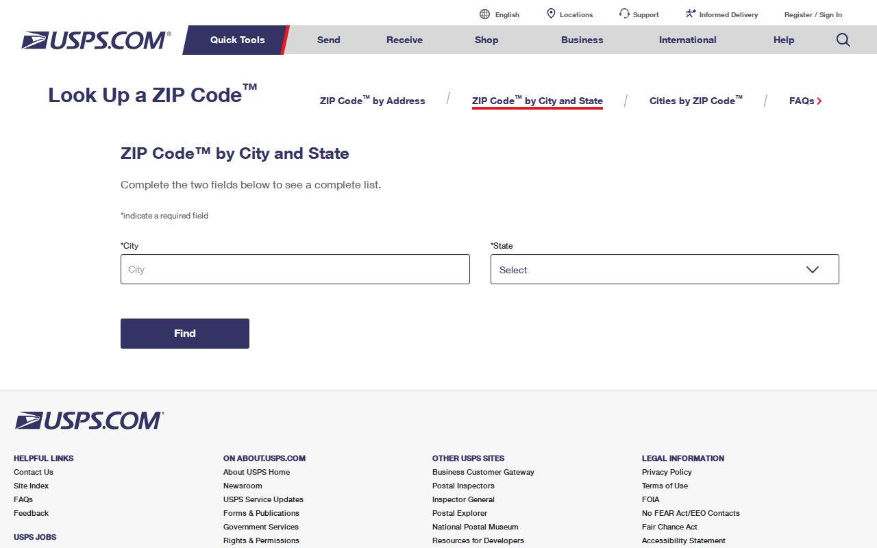
The image is a reminder to verify a code through the postal source before putting it into a request or using it to group addresses. It does not turn the lookup into a Riverside resident index.
Verify a Riverside Address by ZIP Code
For one Riverside address, postal verification should come before parcel research. The by-address lookup can settle a disputed code, a missing ZIP, or a city name that is used by more than one nearby place. It is also the cleanest way to avoid carrying a ZCTA label into a formal request. A verified postal result still says nothing about ownership or occupancy, so it must be joined to a record system that was built for the question at hand.
The USPS address ZIP lookup is the documented address-level route. Its captured screen shows the starting point for checking a complete street address before narrowing a search.
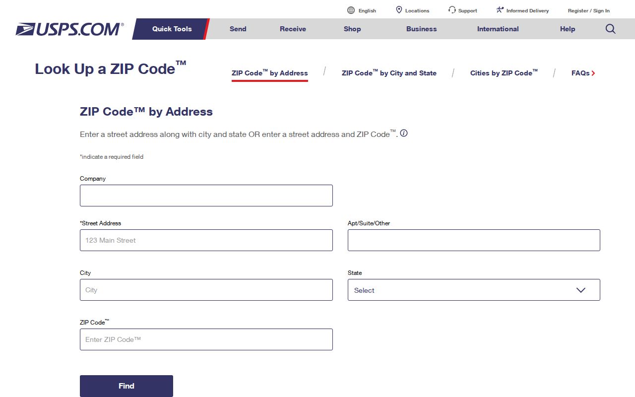
Once the postal result is known, preserve the full address as written. Street number, street name, city, and ZIP together make a better bridge to parcel and permit systems than a ZIP alone.
Find Riverside Records After a ZIP Check
A postal code narrows the starting area, then each Riverside record system adds a different kind of proof. The sequence below keeps a delivery clue from being mistaken for a resident list.
- Verify the complete address through the postal by-address lookup, and save the returned city and ZIP exactly as shown.
- Open Riverside County Map My County, enter the address or APN, choose the suggested result, and use Search and Identify to confirm the parcel and nearby jurisdiction.
- Copy the APN or PIN. The Riverside County Property Search accepts an address, APN, or PIN route. The public interface does not advertise a ZIP-wide or owner-name search.
- Choose the custodian from the city-versus-county result. A parcel inside a ZCTA associated with a neighboring place may still fall under a different permit, code, or records office.
- Use the stable address or parcel key for the next record. A street-level chain belongs in the Riverside street directory workflow, where parcel-by-parcel records are followed by address.
That last step is why postal searches work best as a filter rather than an endpoint. The code identifies a broad geography. The APN, PIN, case number, document number, or exact address identifies the record that can be checked. When the search shifts from a ZIP area to every parcel along one road, use the Riverside street directory for the address-level chain.
Riverside's Four Fringe ZIP Overlaps
The smallest relationship-file overlaps carry the largest warning. ZCTA 92509 touches Riverside but is mainly tied to Jurupa Valley mailing geography. ZCTA 92553 is a tiny eastern fringe associated mainly with Moreno Valley. ZCTA 92571 is a tiny fringe associated mainly with Perris. ZCTA 92860 is an extremely small sliver associated mainly with Norco. Those four rows are geographic intersections, not findings that those municipalities share one resident roll or one postal station.
A second kind of edge appears around 92507 and 92521. The former reaches the east and northeast portions of Riverside, including the UCR vicinity. The latter is described as UCR-associated geography. Use the parcel boundary and exact postal check when a question concerns a campus edge, a service area, or a city department. A ZIP code directory can reveal the need for that check, but it cannot complete it.
The Census ZCTA-to-place relationship file is the source for these intersections. The captured file view makes the distinction between measured overlap and a mailing assignment easier to see.
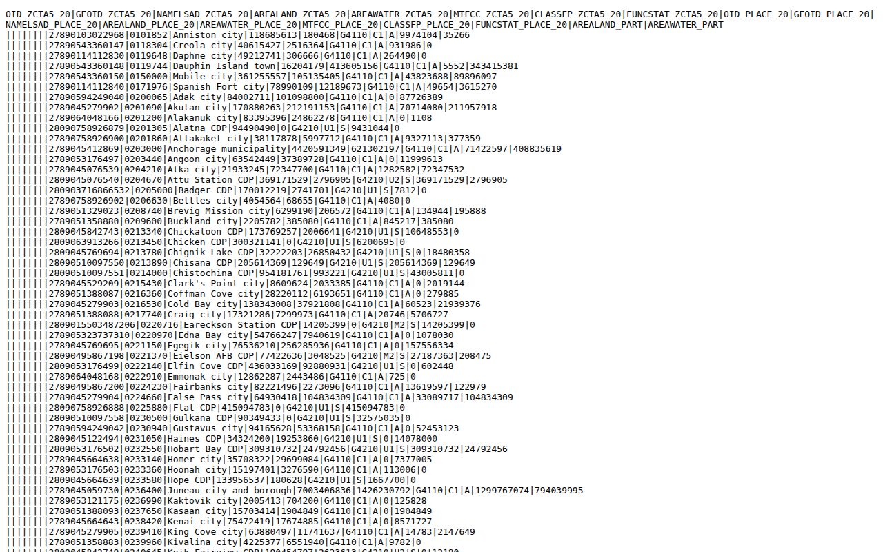
Use the relationship file for geography and the postal lookup for delivery. Do not cite a fringe ZCTA as proof that an address, owner, or resident belongs to a neighboring city.
Find Riverside Residents by ZIP Code
A Riverside ZIP code directory can support a person search only when the next source accepts a verified address or a lawful, defined record request. The research found no inspected assessor or recorder screen that offers a ZIP field for a complete owner list. The county property search is organized around address, APN, and PIN. Map My County supplies visual parcel context. The voter system is even narrower: the personal tool is identity-gated, and a broader voter file requires an application, permitted purpose, fee, security plan, and agreement to use limits.
Riverside's scale is another reason to treat ZIP as a first cut. Census QuickFacts reports 314,998 residents in the 2020 Census and a July 1, 2025 estimate of 323,057. Those are dated population measures, not a current resident file. The Riverside Census QuickFacts entry shows why a broad ZIP filter should be narrowed by address and date before a record is interpreted.
| Channel | What a ZIP can help with | What it cannot establish |
|---|---|---|
| Postal lookup | Confirm the delivery code for a complete address or city-state search | Who receives mail or lives there |
| Census relationship file | Show which ZCTAs intersect the Riverside place polygon | A current address, owner, or resident |
| County GIS | Set spatial context before selecting a parcel | A ZIP-wide household roster |
| Assessor Property Search | Lead from a verified address to an APN or PIN | An advertised ZIP filter or proof of occupancy |
| My Voter Status | Let one voter check their own status and polling information | A public name search or casual block list |
| State voter-file request | Support an approved, defined request when the statutory rules fit | Unrestricted redistribution or an unidentified street list |
For family history, reconnecting, or a property question, keep the purpose narrow and the record key exact. If the needed record is identifiable but not online, a focused request to the correct city or county department can ask for an existing, nonexempt record. The California Public Records Act does not require an agency to create a new ZIP directory or answer an open-ended research question.
Riverside Property Keys Beyond Postal Geography
Property research gets more reliable when each label keeps its own role. A ZIP describes delivery geography. A situs address identifies where a parcel sits. A mailing address tells the assessor where notices go, which can be a different place. An APN or PIN joins the parcel to county systems. A legal description, often preserved with a recorded document, can carry the trail through a street-name change. These distinctions matter in Riverside's fringe areas and in older records where an address may no longer look familiar.
- ZIP code
- An operational postal code assigned to an address, confirmed through a postal lookup.
- ZIP+4
- The added four digits used by postal systems to refine delivery beyond the five-digit code.
- ZCTA
- A Census statistical area that approximates ZIP geography for mapping and comparison.
- APN
- Assessor's Parcel Number, the county parcel key used to join property records.
- Situs address
- The location of the parcel or structure, distinct from where an owner receives mail.
- Legal description
- The recorded land description that can preserve parcel identity when a street label changes.
Research did not verify a Riverside PO-box-only ZIP, unique institutional ZIP, carrier-route list, or station-by-station inventory. Those categories exist in postal practice, but no Riverside code should be placed in one without a current authoritative source. Keeping that gap visible is safer than turning a commercial label into a local fact.
Riverside Search Channels by ZIP Code
Different questions call for different contacts. The following routes cover the documented online, counter, and request paths without suggesting that one office owns every Riverside record.
| Need | First route | Fallback or contact detail |
|---|---|---|
| Postal code for one address | USPS by-address lookup | Use the city and state lookup for a place-level cross-check; station names were not established here |
| City boundary and parcel context | Map My County | Use the City of Riverside public GIS map for municipal context |
| APN, PIN, and property evidence | County Property Search | Assessor office computers and microfiche; Gateway is at 2724 Gateway Drive, Riverside, and offices are generally open Monday through Friday, 8 a.m. to 5 p.m. |
| Personal voter status | California My Voter Status | Riverside Registrar of Voters, 2720 Gateway Drive, 951-486-7200 or 800-773-VOTE |
| Existing city record | Riverside public-records portal | Use a focused CPRA request naming the department, date range, address, and record type |
The county Assessor-County Clerk-Recorder also maintains counter and archive routes for property and historical records. A postal code can help describe the request, but an exact address, APN, date range, or document number makes the request workable.
Riverside ZIP Code Limits on Resident Searches
A postal code does not reveal every person at an address, and a city boundary does not turn a parcel roll into a household roster. Property data is ownership and assessment evidence. Voter data is purpose-limited. Court, vital, and DMV information has its own access rules. Safe at Home participants, confidential voters, protected certificate data, and sealed records can be absent by design. A negative online result may reflect a boundary, an older record, a redaction, or a portal limit rather than proof that a person was never in Riverside.
Lawful use. Riverside ZIP code directory research is appropriate for personal records work, genealogy, reconnecting, property history, and civic understanding. Do not use a ZIP, parcel, or public filing to stalk, threaten, harass, or intimidate anyone; public access does not remove those limits.
Commercially compiled neighbor and people-search products can merge same-name records, omit the source trail, or retain stale data. Official Riverside and California custodians are better for verification, while historical collections are better for dated context. ZIP geography is the first cut. The record key and the custodian supply the answer.